BLOG • November 29, 2019
Reaktor Hello World celebrating its first year in orbit

With two million kilometers on the meter, it's impressive to see how well RSL is thriving in such a harsh space environment.
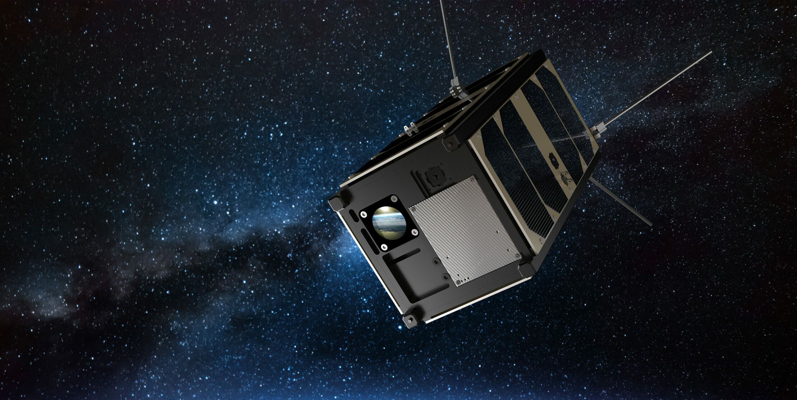
It has been quite a ride for our first satellite, Reaktor Hello World (RHW), during its first year orbiting the Earth. RHW has traveled over 2 million kilometers, and if flying straight, it could have gone past Mars and is approaching the asteroid belt.
An eventful year is behind us, and here are some highlights:
- We successfully launched the satellite on the 29th of November, 2018.
- Immediately after the launch, we confirmed that all in-house developed safety-critical subsystems of the satellite worked as expected.
- The journey began with much anticipation – would the satellite perform as we had hoped?
- After a year, we proudly share that no serious malfunctions surfaced. Especially nothing that the satellite could not autonomously recover from. No onboard system degradation was observed, even though flying through the harsh radiation environment of Earth’s polar regions every 45 minutes or so.
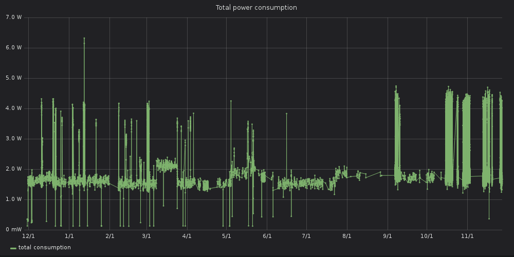
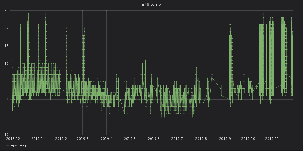
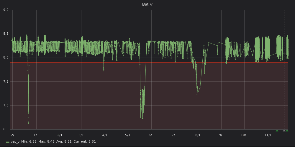
Here are some onboard telemetry readings for the first year:
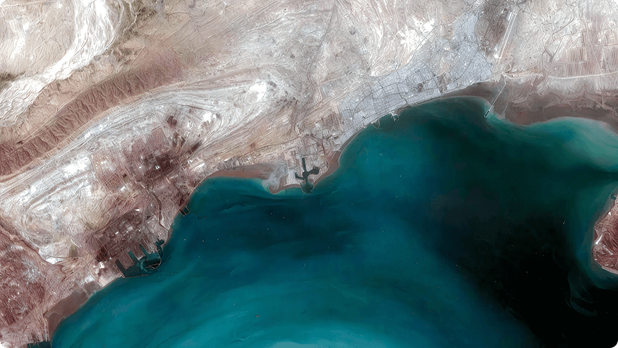
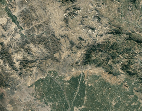
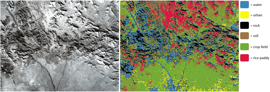
In addition to validating our onboard technologies, the mission’s primary objective is to test a novel infrared hyperspectral imager developed by the VTT Technical Research Centre of Finland. Already in the first weeks of operations, we could not keep our hands off the precious payload instrument and captured many breathtaking images from around the globe. With the first images taken from the Sahara desert, we could already validate that the satellite can detect soil moisture and mineral composition – something that has never been done with a nanosatellite before!
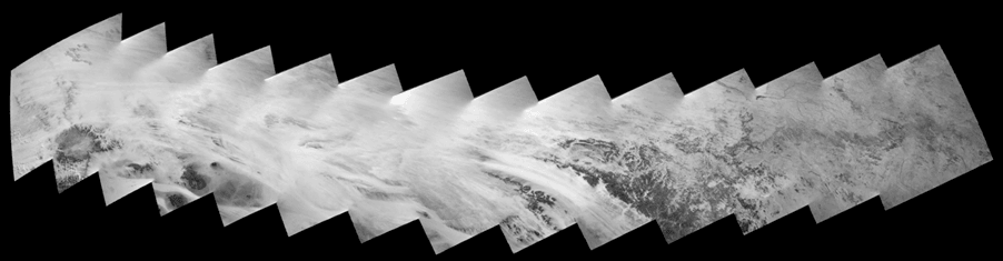
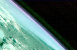
As the satellite’s altitude control was not yet commissioned, it tumbled around and accidentally captured the Earth’s horizon in multiple photos. The images showed clear traces of oxygen and water vapor on specific wavelengths. While not surprising for us on Earth, these images could be highly valuable for detecting gasses on other planets.
Our team has collected hundreds of images from various targets worldwide and continually analyzes the data. It takes time, as no similar instrument has been deployed in a satellite. Many potential applications for the data may still be unidentified. The imager functions correctly, and our team has gained valuable experience improving it for future next-generation versions.
The mission was a success and raised our confidence to use our satellite technology and hyperspectral imager for new ambitious missions, which was the primary goal. We are developing a higher resolution imager for Earth orbit and preparing for deep space asteroid prospecting missions, among other projects. We’ll keep you posted about these and further updates about the Hello World mission in the near future!
The article was written by Tuomas Tikka (Reaktor Space Lab CEO) and Antti Näsilä (Reakor Space Lab Hyperspectral Payload Engineer (VTT)).