BLOG • October 28, 2026
Seeing more in the same picture: what our Copernicus pilot showed about Europe's land cover

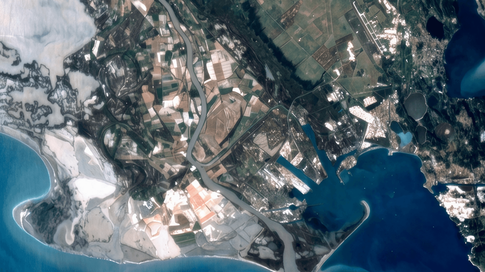
Europe already has a detailed view of its land from space. Copernicus imagery helps governments, researchers and companies track agriculture, forests, cities and how they change. The challenge isn’t collecting more images. It’s getting more information out of the ones we already have.
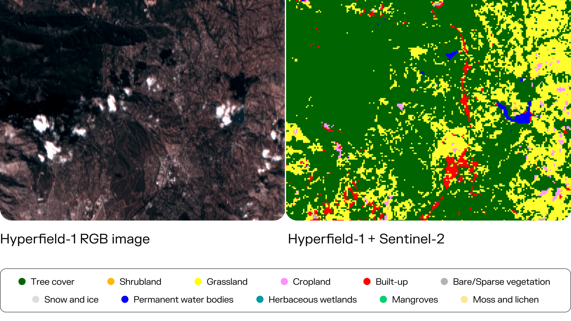
That was the idea behind our pilot under the Copernicus Contributing Missions program. We tested whether adding hyperspectral data from our Hyperfield-1 satellites to existing Sentinel-2 imagery would improve land-cover classification. It did: Combining the two produced more accurate land-cover maps than either source alone, and more accurate maps than ESA’s WorldCover product.
Seeing what conventional satellite imagery misses
Conventional multispectral satellites observe the Earth using a relatively small number of broad wavelength bands. Hyperfield satellites capture reflected light across dozens of narrow spectral bands. That lets AI models detect subtle differences between vegetation, soil and other materials that can look alike in conventional imagery.
A robust in-house AI model automates various sensor data and analytics processing, continuously updating land-cover changes for global end users.
The pilot showed that the two kinds of data capture complementary information, with each picking up details the other misses. That matters most for organizations already using Copernicus data. Because the two sources work best together, those organizations can add hyperspectral data to the Earth-observation workflows they already run, and identify land-cover types more accurately across large areas.
What the pilot showed
Between June 2025 and May 2026, Hyperfield-1 collected 98 hyperspectral images covering roughly 90,000 km² across five test areas in Greece, Romania, France, the UK and Russia.
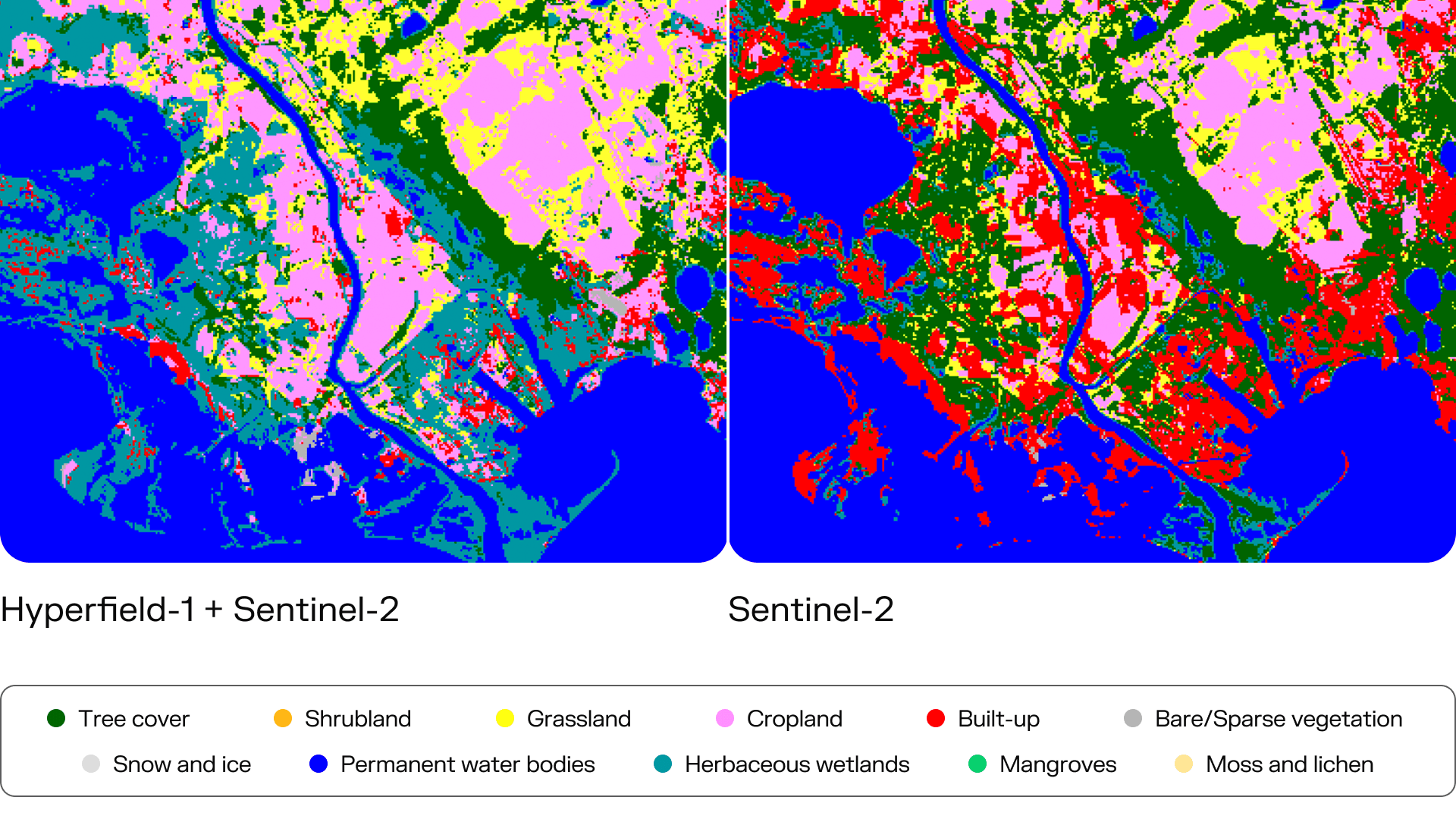
We combined that imagery with Sentinel-2 data and an AI-based classification model. In a targeted validation, we compared the results against land cover mapped by hand from up-to-date Very High Resolution imagery in three areas:
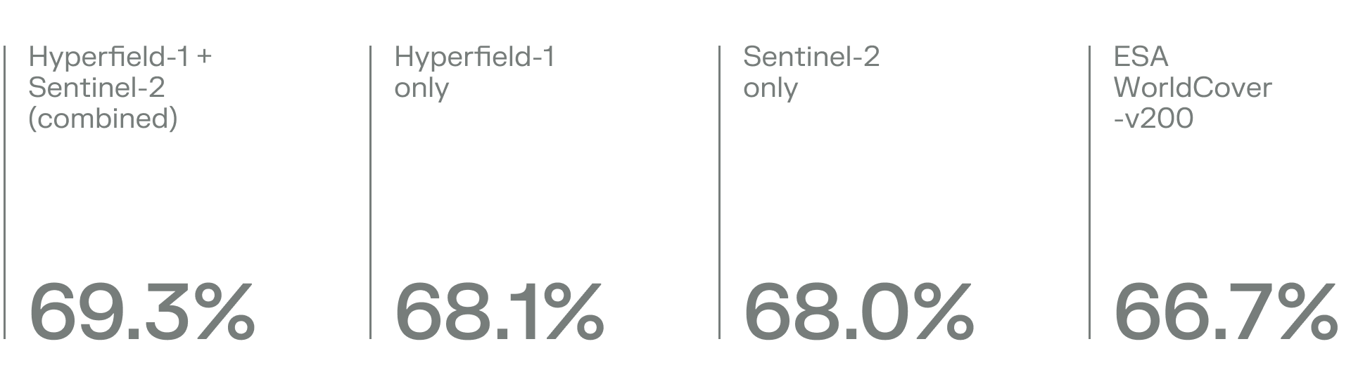
The combined model outperformed both single-source models.
We already have the satellite imagery. The challenge is getting enough information from it to see what’s actually changing on the ground. This pilot shows that hyperspectral data can make the Earth-observation systems governments rely on more precise, helping them distinguish smaller and subtler differences across very large areas.
The data itself held up as well. Both Hyperfield-1 satellites met the study’s major data-quality targets for radiometric accuracy, temporal stability and geolocation. Checked against RadCalNet, a global network of calibration sites, mean surface-reflectance error was 2.4% for HF-1A and 3.0% for HF-1B, well within the target of below 10%.
Cloud matters in day-to-day mapping. When one input contained cloud, the combined model learned to rely more heavily on the clearer source. That preserved the quality and temporal coverage of the land-cover prediction, so cloud over one source doesn’t leave a gap in that day’s mapping.
Speed matters too. Our automated AI-based processing pipeline can produce analytics outputs in under 10 minutes once data reaches the ground station.
Why this matters now
Demand for more detailed, timely land information is growing across Europe. EU Member States were due to submit their first draft national restoration plans under the Nature Restoration Regulation by 1 September 2026. Those plans set out how each country intends to meet restoration targets through 2030 and beyond.
The regulation requires restoration measures to cover at least 20% of EU land and sea areas by 2030. That creates a growing need to understand where ecosystems are changing and whether restoration measures are delivering results.
The Copernicus Land Monitoring Service already uses land-cover information extensively to track changes in vegetation, agriculture, forests, urban areas and other land environments. More accurate classification could improve how governments, researchers and companies monitor agricultural land, biodiversity, urban expansion and climate-related land-use change.
From pilot to operational monitoring
The pilot also showed consistency between our HF-1A and HF-1B satellites. That’s an important requirement for scaling up from individual images to a constellation-based service.
We are building our next six Hyperfield satellites and plan to expand the constellation to provide subdaily global coverage by the end of 2030. Our next-generation Hyperfield-2 satellites will add Short-Wave Infrared sensing and higher-resolution RGB imagery. They are designed to better separate land-cover types that current systems still struggle to tell apart, such as snow, built-up areas, bare soils and shrubs.
This pilot confirms multimodality improves land cover mapping. With 70+ Hyperfield satellites in orbit by the end of the decade, we will improve not only accuracy but also temporal coverage of land cover mapping and land cover changes globally.